Geography
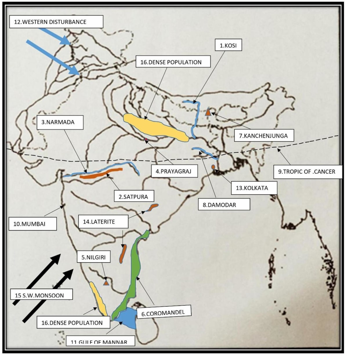
Mark and name:
- A left-bank tributary of the Ganga River that is famous for floods.
- The hill range located between the rivers Narmada and Tapi.
- A river flowing through a rift valley.
- The city through which our standard meridian passes.
- A hill called Blue Mountain.
- A coast getting rain in retreating monsoon time.
- The peak shared by Nepal and India.
- A river called the Sorrow of Bengal.
- The latitude marking the northern limit of the sun's apparent movement.
- The commercial capital of India.
- The Gulf between India and Sri Lanka.
- The wind bringing rain in winter in northern India.
- A river port.
- An area with laterite soil.
- The direction of S-W Monsoon wind.
- An area with a dense population.
Related Questions
Map sheet no. G43S7: Eastings 29 to 38 and Northings 85 to 94.
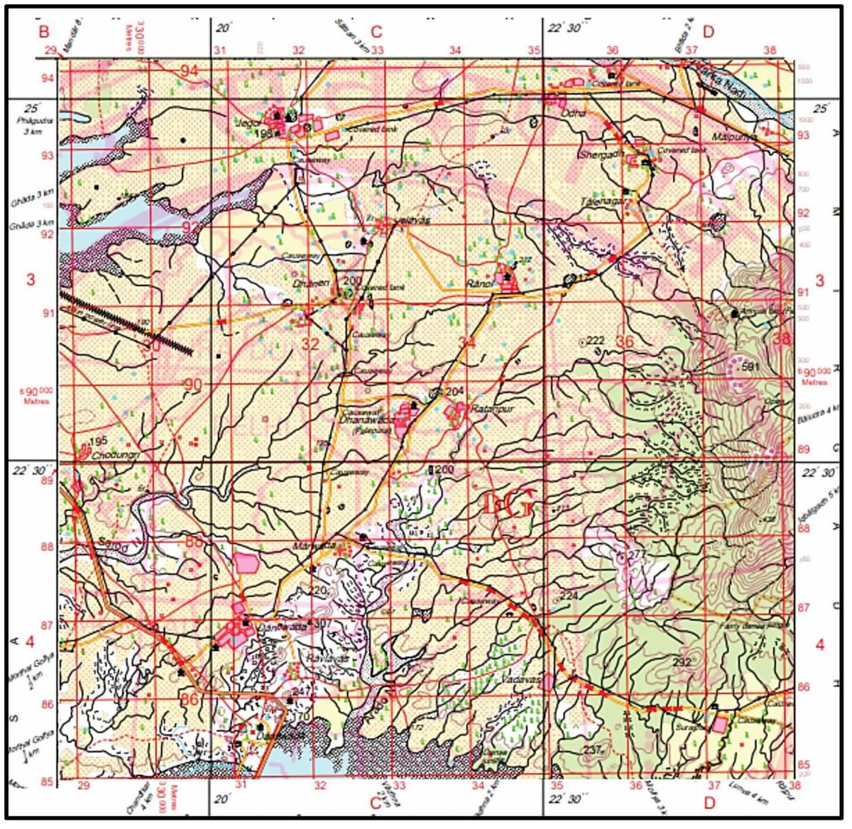
Why are covered tanks found in many places of the map extract? Give two reasons.
Map sheet no. G43S7: Eastings 29 to 38 and Northings 85 to 94.
How much time shall be taken for a person if he is moving from Northings 85 to 94 in a straight line at a speed of 1 km per hour?
Give the six-figure grid reference of the following from the given map extract:

(a) Police Station.
(b) 4r near the rocky knob.
(c) Post office at Malgaon.
(d) The Surveyed tree at Posintra.
(e) Dispensary north of Posintra
(f) Hospital near Pamera
What is the National Grid Reference (NGR)?