
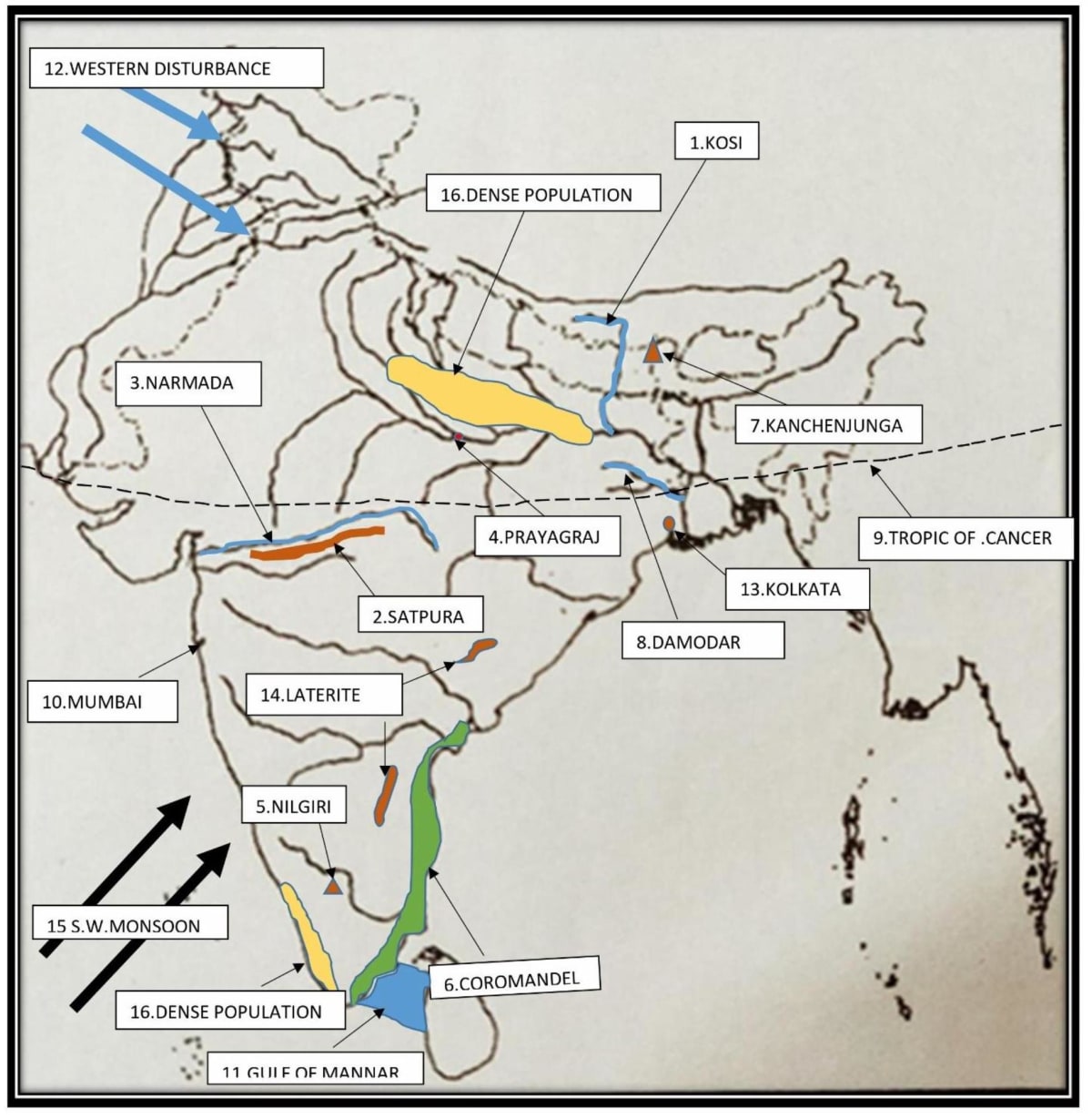
Geography
Mark and name:
- A left-bank tributary of the Ganga River that is famous for floods.
- The hill range located between the rivers Narmada and Tapi.
- A river flowing through a rift valley.
- The city through which our standard meridian passes.
- A hill called Blue Mountain.
- A coast getting rain in retreating monsoon time.
- The peak shared by Nepal and India.
- A river called the Sorrow of Bengal.
- The latitude marking the northern limit of the sun's apparent movement.
- The commercial capital of India.
- The Gulf between India and Sri Lanka.
- The wind bringing rain in winter in northern India.
- A river port.
- An area with laterite soil.
- The direction of S-W Monsoon wind.
- An area with a dense population.
Topographical Maps
34 Likes
Answer
Map:
Answered By
19 Likes
Related Questions
What are the topographical maps?
Map sheet no. G43S7: Eastings 29 to 38 and Northings 85 to 94.
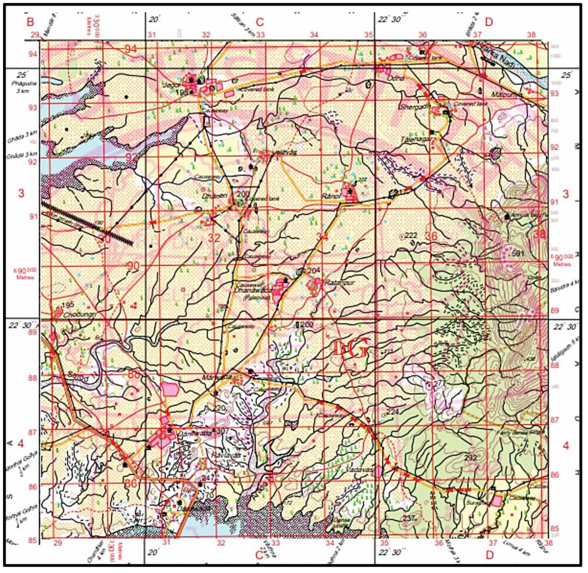
Name the most important occupation of the people living in this area, giving a reason for the same.
Map sheet no. G43S7: Eastings 29 to 38 and Northings 85 to 94.
Why are covered tanks found in many places of the map extract? Give two reasons.
Map sheet no. G43S7: Eastings 29 to 38 and Northings 85 to 94.
What does “dep” signify in grid square 3390? Name the agent responsible for it.