
Geography
Map sheet no. G43S7: Eastings 29 to 38 and Northings 85 to 94.
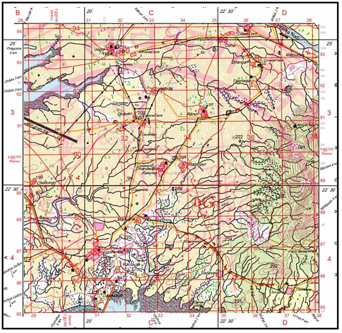
Why does most of the area have cart tracks?
Topographical Maps
25 Likes
Answer
Most of the area in the map shows cart tracks due to following reasons:
- It is an underdeveloped village area where agriculture is the main occupation.
- Underdeveloped rural areas don't have developed industries, hence no need for heavy vehicles and paved roads.
- Lack of infrastructure development leads to people using bullock carts, handcarts, etc. for transporting goods from place to place.
Answered By
12 Likes
Related Questions
Study the images given below and answer the questions that follow.
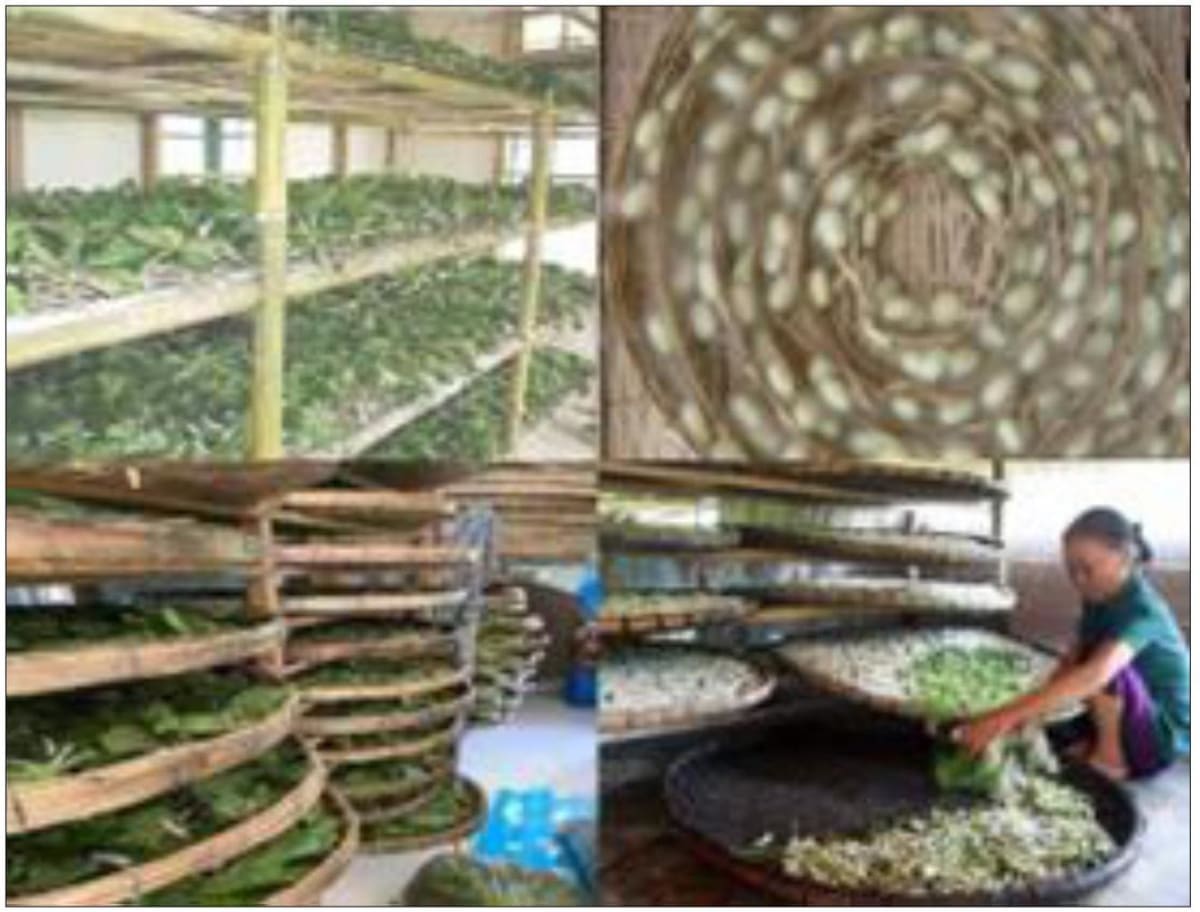
(a) Which textile industry is associated with the given images?
(b) Name the state where this industry is thriving.
Map sheet no. G43S7: Eastings 29 to 38 and Northings 85 to 94.
Why are covered tanks found in many places of the map extract? Give two reasons.
Map sheet no. G43S7: Eastings 29 to 38 and Northings 85 to 94.
How much time shall be taken for a person if he is moving from Northings 85 to 94 in a straight line at a speed of 1 km per hour?
Map sheet no. G43S7: Eastings 29 to 38 and Northings 85 to 94.
Name the most important occupation of the people living in this area, giving a reason for the same.