Geography
Study the picture given below and answer the following questions:
(a) State whether the above station experiences a maritime or a continental climate. Give a reason for your answer.
(b) Name the winds which bring rainfall to the station.
(c) Name a probable station experiencing such climatic conditions.
Answer
(a) The given station experiences Maritime climate. This is because the temperature remains moderate throughout the year with not much variation between summers and winters.
(b) The South-West Monsoon Winds bring rainfall to the station.
(c) A probable station that experiences such climatic conditions is Kochi.
Related Questions
India has a long coastline of 5,560 kms., having access to the sea on three sides with 11 major and 168 minor/intermediate ports. India lies in geographical proximity to important shipping routes, which gives a natural advantage to the country's shipping.
Source- Directorate General of Shipping, Government of India.
(a) Name the means of transport developed due to the above-mentioned geographical feature of India.
(b) State any two advantages of the means of transport you mentioned.
Study the given map and answer the questions that follow.
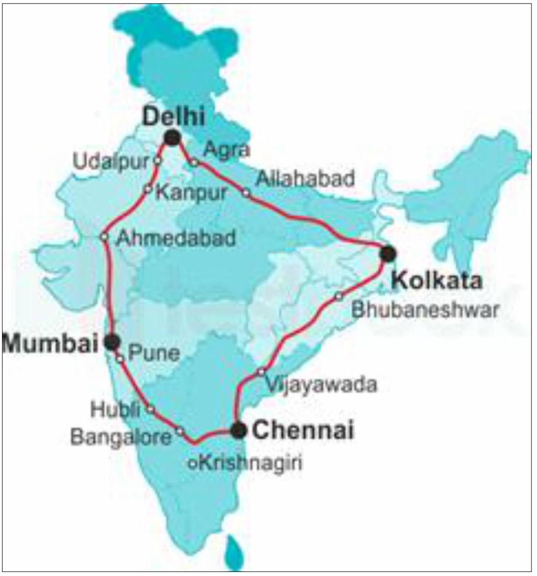
(a) Name the highway project shown on the given map.
(b) State any two economic benefits of this project.
Although landfills are the cheapest waste management strategy, they are often touted as harmful to the environment.
Name any three ways by which landfills cause harm to our environment.Below are the two pictures of an efficient waste reduction and waste management system.
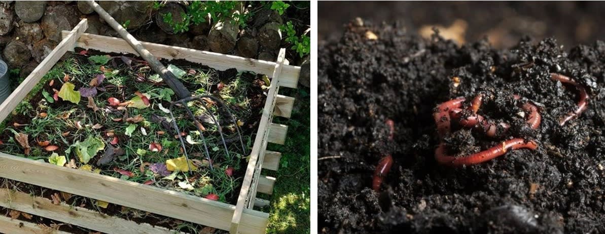
(a) Note the pictures carefully to mention the difference between the two.
(b) What additional advantages does the waste management seen in the picture on the left have over the waste management seen in the picture to the right?