
Geography
Study the survey of India toposheet G43S10 given and answer the following questions.
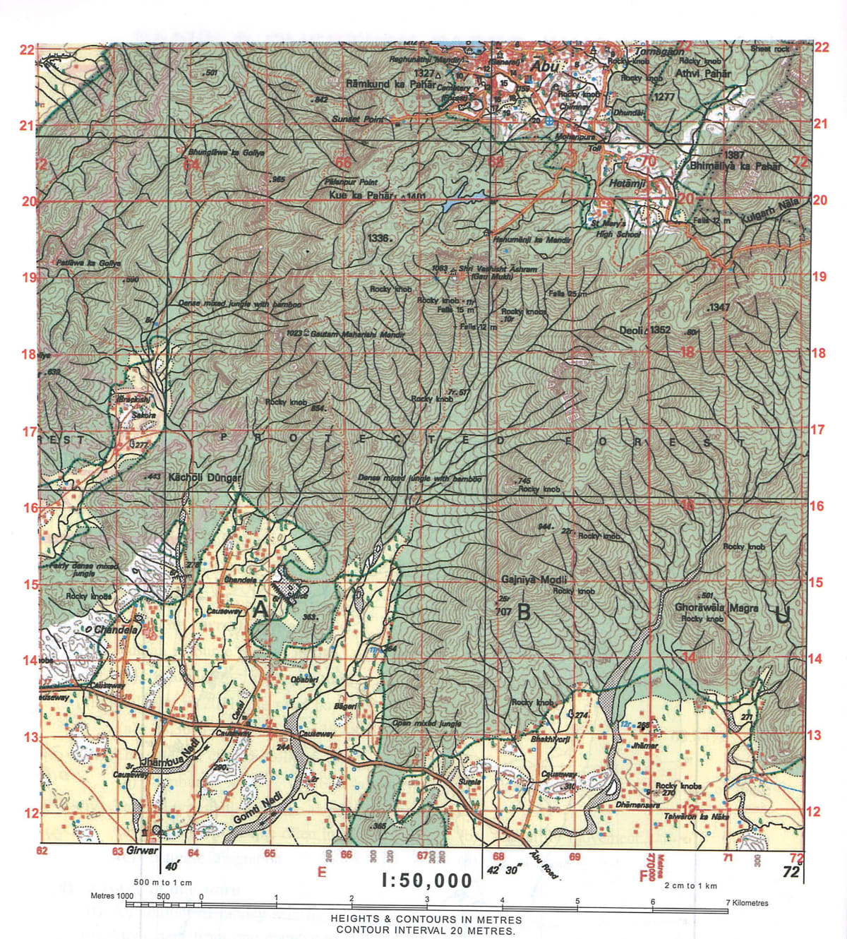
(i) Which is the largest settlement? Name and identify it.
(ii) Identify a steep slope shown on the map and give four figure grid reference of the same.
(iii) In what colour are contour shown on the map? What is meant by Index contours?
(iv) Name the settlement patterns shown in the given survey sheet. Why is Abu an important town?
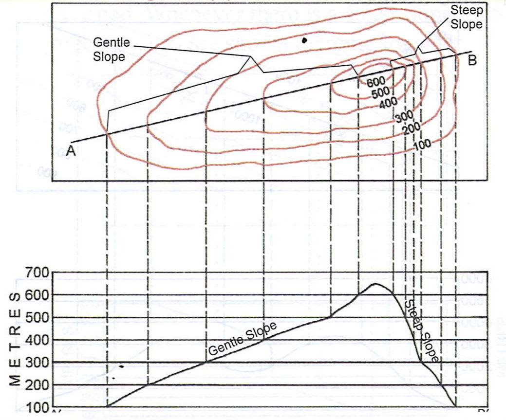
(v) Draw a neat diagram of gentle slope and steep slope.
Geographical Features
6 Likes
Answer
(i) Abu is the largest settlement.
(ii) Grid reference 7120 shows a steep slope.
(iii) Contours are shown with brown colour on the map.
The ordnance survey maps of 1:50,000 scale have contours drawn at the vertical interval of 20 m. Although the contour interval is 20 m, in the topographical maps one finds the heights shown as 100 m. To make the contour maps distinct, every fifth line in multiple of 20 m is accentuated and this is called Index contour.
(iv) The settlement patterns shown in the given survey sheet are-
- Nucleated settlement
- Linear settlement
- Dispersed settlement
Abu is an important town as it contains the following facilities-
- It is well connected by roads.
- It has temples.
- It has a dispensary.
- It has a police station.
(v) Below is the contour diagram showing a gentle slope and steep slope:
Answered By
2 Likes