
Geography
This is the picture of an instrument.
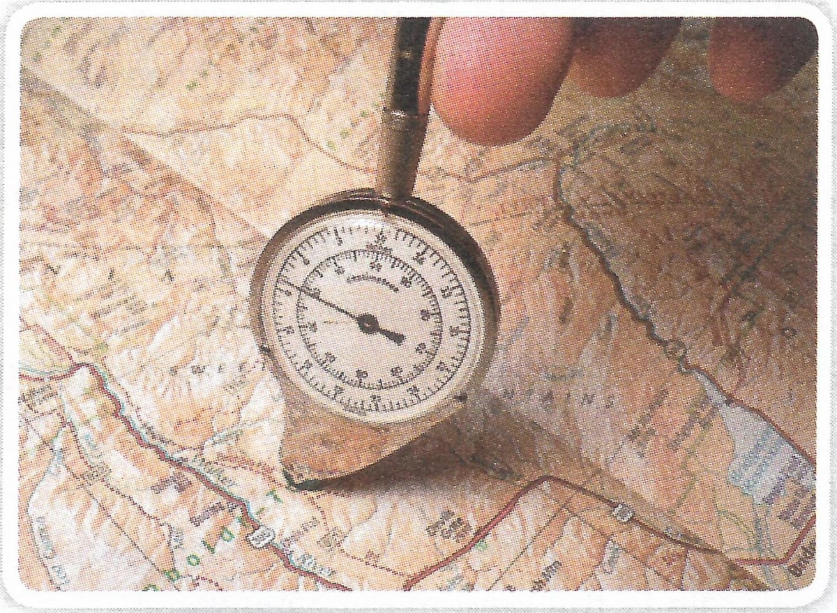
- Name this instrument.
- What is it used for?
Geographical Features
9 Likes
Answer
- The given instrument is an opisometer.
- It is used for measuring the curved line distance on the map.
Answered By
5 Likes
Related Questions
Write the names of three features that brown and green each show on a topographical map.
How are the scales stated in the statement, representative fraction and graphic scale methods?
How is the straight-line distance measured on a map?
Draw conventional signs and symbols for footpath with bridge, town, height, palmyra palm and tidal river.