
Geography
See the picture alongside, which depicts an environmental disaster. Identify it.
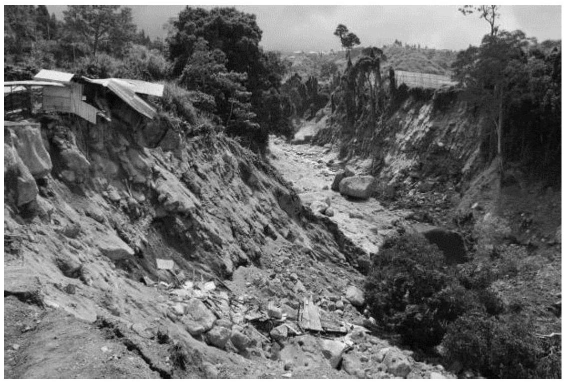
(Source: www.istockphoto.com )
- Soil erosion through landslides.
- Soil erosion through an earthquake.
- Soil erosion through perennial droughts.
- Soil erosion through shifting cultivation.
Soil Resources
2 Likes
Answer
Soil erosion through landslides.
Reason — Landslides involve the sudden downward movement of large masses of soil, rock, and debris from a mountain or hill slope. When this happens, the top fertile layer of soil is rapidly removed, resulting in severe soil erosion. This not only depletes the soil cover but also damages vegetation and makes the land unfit for agriculture.
Answered By
1 Like
Related Questions
River Rafting is journeying on a torrential river on an inflatable rubber boat. Rivers originating at high altitudes have torrential flow near their source.
Which of the following places would be suitable for river rafting?
- Gomti in Lucknow
- Hughli in Kolkata
- Ganga in Rishikesh
- Sabarmati in Ahmedabad
In certain parts of India, glaciers are the main source of water. The people in these areas use an innovative water harvesting technique by diverting glacier streams into small tanks. It is usually done in the evening when the glaciers are relatively melted. Which of these regions could be practising this?
- Khasi and Jantia hills
- Ladakh region
- Siwaliks hills
- Tarai region
Which of the following figures is akin to the landform of the Deccan Plateau?
- 1.

- 2.

- 3.

- 4.

The state of Arunachal Pradesh wants to encourage cottage industries in the state. Considering the natural resources and geographical factors of the region such as its high rainfall and temperate climate, which of these crafts is the best option to pursue?
- Ceramic pots and terracotta art
- Decorative shell article
- Bamboo and cane craft
- Brass metal craft